Wednesday, 28 November 2012
January Challenge - NEW DATE
NOTE - The villagehouseinspain 2013 January Challenge (Roldans Notch) will now take place on Saturday January 12th 2013 (previously January 19th).
Saturday, 24 November 2012
Puig Campana - Recce and Run!

I was keen to check out one of the timings ref. 'The 2013 January Challenge' (Roldans Notch). This meant that I would need to ascend the Puig via the gully on the Finestrat side (PR-CV14). Because I had recently been impressed by the speed that competitors had gone up the mountain (the winner in just over 35 minutes) as part of the Skyrunners Vertical Kilometre race, I was curious to see how quickly I could do it - apart from being in a different league to these guys, I had absolutely no intention of running up the mountain (down it maybe, but not up!).
So, I started my little excursion at 08:00 this morning, setting out from Font Moli, just above/behind Finestrat village. It was all fairly quiet at that time, but a couple and a single guy were all setting off just as I was parking my car. I never saw the couple again (they may have gone on a different walk) but I did pass the single guy several hours later as I was coming down (he was still on his way up and about 200m from the summit).
The timing that I was interested to check was how long it would take to reach the point in the gully where you turn left (coming up from the bottom) and start the scramble up to the notch. Previously we had parked in the valley just below (20 min walk) the refuge/hut (Refugio José Manuel Vera Catral) we then walked up to the coll (@ 1200m) before dropping 200m down the gully to the point in question, this had taken just under 2 hours, and the 200m descent down the gully had not been the most pleasant experience! Today, coming directly up the gully (admittedly on my own and not hanging around) I reached the same point in 1 hour and 10 minutes - good news for January!
So, now I was able to focus on reaching the summit, 730m of ascent done, just another 270m to go! It was a steady slog, but a beautiful morning for slogging, with blue, cloudless skies, although now as I got nearer to my goal, the wind seemed to pick up with every metre of ascent, and 25 minutes later as I stood on top of the Puig it was really quite strong and did not encourage me to hang around!
To see the GPS data for the ascent on Garmin Connect CLICK HERE
To see the GPS data for the ascent on Garmin Connect CLICK HERE
Although my ascent had taken an hour longer than the winner of the Vertical Kilometre Race, I was still very pleased with my efforts (1:35:25) and I had actually done it quicker than some of the competitors! After snapping a few quick photos I began what I hoped was going to be a quick descent. I had decided to descend via the slightly more forgiving and slightly gentler route that joins and follows the circular path (PR-CV289). Although further, 7.46Km vs 4.76Km on the way up, I was still optimistic that I could get down quicker than I had come up. Wherever possible I ran back down and was back at Font Moli and the car in 1:13:37.
Sunday, 18 November 2012
Saturday, 17 November 2012
Old Eric Proverb
"if you have 4 legs, are small, black and fat - then DO NOT go out in Sella countryside on day of Gran Batida" (wild boar hunt) Mabel!!!

At 8 o'clock this morning men with guns and lots trailers full of hunting dogs (like the one pictured below) met up at the Sella car park. This just happened to be the time that Eric, Mabel and myself were off for a bit of a morning stroll, past the car park!
Mabel really does need to learn that there is a time to give it large, and there is a time not to give it large - and 8 o'clock this morning was definitely NOT the time not to be giving it large (barking her head off) as we walked past numerous trailers, laden with hunting dogs, who's sole objective for the day, was to chase short, black, fat 4 legged animals around the countryside! They were going mental when they saw her - thankfully the trailers are rather well made!
.JPG)
Thursday, 15 November 2012
Morning Stroll - Ruta de Agua (baixa)
After some heavy rain over the last week or so the Sella rivers are both flowing well, as is the waterfall down by the mill which we walked past on our morning stroll as part of the Ruta de Agua (Baixa).

If you want to see where we went CLICK HERE
Wednesday, 14 November 2012
Bite!

The teeth that inflicted this little nibble had four legs attached to them!
Tuesday, 13 November 2012
Sunday, 11 November 2012
Skyrunning!
Skyrunning is defined as the discipline of running up mountains, up to or exceeding 2000 meters and where the incline exceeds 30% - I think it is therefore, by its nature, what one would call an extreme sport!!!
Anyway, one discipline of the sport is called the Vertical Kilometer Seris and this year there have been 5 races, the first 4 being in Russia, Greece, Italy and Switzerland. The 5th and final Vertical Kilometer race of the year took place today in our neighbouring village of Finestrat, where competitors (or lunatics - depending on your perspective) were invited to run up the Puig Campana Mountain! Oh, and of course the route was not the slightly easier circular path, oh no, but straight up the scree!
Anyone who is vaguely familiar with the mountain, will appreciate that the idea of running up it is somewhat challenging, let alone actually doing it. Well just to give you an idea of how incredibly fit some of these people are I will tell you how long it took the winner (and you aint going to believe this!) 35 minutes and 46 seconds! That is truly incredible.

Monday, 24 September 2012
villagehouseinspain January Challenge 2013
The following video shows you where we are planning to go!
The question is will you be joining us?

The proposed date
for our 2013 January Challenge is Saturday 19th January 12th January (new date). We will be starting
early (before sunrise) from Font Moli (behind Finestrat village) and heading off
straight up the Puig Campana mountain via the steep and direct path that follows
the line of scree. However, once we reach a height of approx 1100m we will be
turning left off the path and at this point our walk becomes a grade 2 scramble
as we head up to Roldans Notch itself! After spending a bit of time in the notch
we will be retracing our steps back down to the scree where we will continue up
to the coll. From here those who want to feel that they really have 'Done the
Puig' will head off to stand on the summit, before we all descend via the
traditional route.
All in all it
should be a great day out, and a relatively short walk (approx 13Km) but one
that includes an approximate total ascent of 1500m!!!
Of course the main
thing is that you will get to stand in Roldans Notch - a place where many would
like to go, but few have!

Saturday, 22 September 2012
UPDATE #2 - 22/09/12 - re Relleu Por El Camino De Santiago

Following a further bout of exploring during which we found the route of an ancient but now little used path, but one that proved to be the missing part of the puzzle! So, we have finished up with the great little walk of 18.6Km (shown in pale blue on the map) this is 3.4Km shorter than the 2nd version (dark blue) and still manages to avoid the several Km´s along the main road in version 1 (pink).

The missing part of the puzzle!
Thursday, 20 September 2012
UPDATE 20/09/12 - re Relleu Por El Camino De Santiago
Having just done the walk for a second time, but varying the initial section so as to avoid the main road (CV770) completely (shown on map below in blue vs 1st route in pink). This is although slightly further a much better route.

Monday, 17 September 2012
Relleu Por 'El Camino De Santiago'

2 wrongs can make a right!
Wrong #1 - Whilst walking with a Steve G a month or so ago, our walk went somewhat wrong due to a large quantity of new fencing that had appeared, blocking our way and forcing us to modify and extend our walk. It was during this diversion, that the conversation turned towards our neighbouring village of Relleu. We were both in agreement that to our knowledge, the only realistic route from Sella to Relleu and back again was a linear walk, which although a nice walk, meant that the outward and return legs both followed the same path. We agreed how much better the walk would be if it were to be a circular route that could include a stop off in Relleu for refreshment.
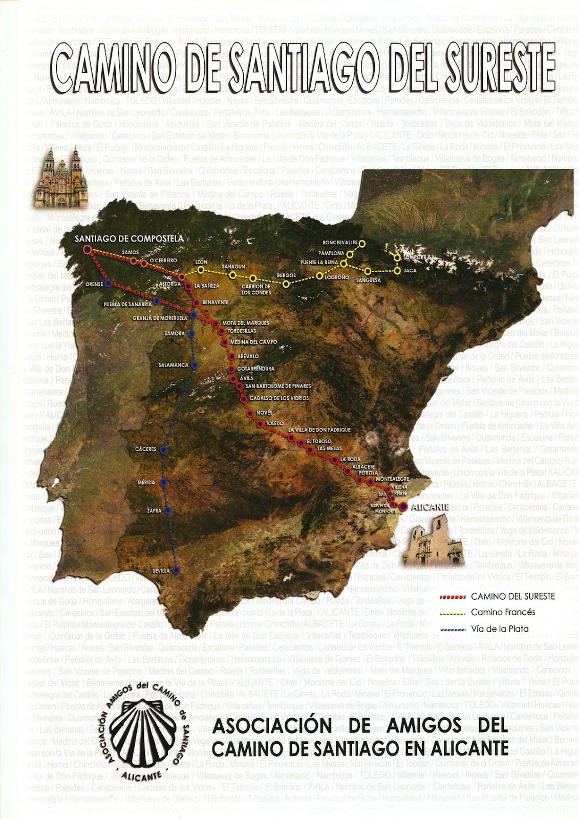
Wrong #2 - Earlier this week we thought we would take advantage of the continuing glorious weather and have a day on the beach at Villajoyosa. I set off an hour before Angela, the plan being that I would run down to the Orcheta Resevoir where she would pick me up in the car en route. Unfortunately when Angela was ready to leave, the car would not start (flat battery - my fault!). So, I decided that seeing as it was such a nice day, I would just walk back up to Sella. While I was walking through the village of Orcheta I noticed a ceramic tile that featured a yellow arrow and the words Camino de Santiago. Although I was vaguely aware of a 1200Km walk from Alicante to Santiago de Compostela (the Camino Del Sureste) I had no knowledge of its exact route. Anyway as I continued Sellawards, for the next couple of Km's or so I noticed more yellow arrows painted on the side of the road, until eventually they indicated that the route went off to the left away from the main road and up an easy to miss but inviting little path. I resisted the tempting invite! but, following the yellow arrows had brought back happy memories of my own walk to Santiago via the Camino Frances or Camino Real back in 2005. Once home a bit of research on the Internet showed me that what I had actually stumbled on was the 'Ruta Central' leg of the Camino Del Sureste which joins the main Sureste path at Villena before it heads north via Madrid and on to Santiago de Compostella - mmm, now theres an idea!!! However, what was of interest to me at this moment was that from where the camino and I had parted company, the next village that it would pass through was Relleu - at this point in my head the idea of a circular walk starting in Sella and passing through Relleu was suddenly becoming much more of a reality, and further research was required!
So at 07:00 this morning Eric and I set off to investigate this potential new walk. For the initial 6Km section from Sella to where we picked up the Camino route, we managed to avoid the main road for about for about half of the way, and I believe that with a bit more research we may be able to eliminate the main road completely. Once on the Camino we were initially led up a fairly steep but wonderful little path that took us through some stunning scenery, never having to go too far before coming across another reassuring yellow arrow. My fear was that once up this initial part of the Camino, it would simply rejoin the main road all the way to Relleu. What I was hoping was that the Camino would stay away from the road and follow paths and tracks all the way. Well, I was in luck! With the exception of a very short section on the road, we were on paths and tracks for the whole way to Relleu. Considering the proximity of the two villages, the difference in landscape is quite surprising, the terraces of this part of Relleu being generally much bigger and flatter than those of Sella, and much to Eric's delight (unlike around Sella) we seemed to come across a rabbit with every turn! Once in the village of Relleu, options include a drink or something to eat in one of the bars and a visit to the castle before returning to Sella via the popular and well known PRV route - long live the Sella Relleu Circuit!
MHS - 16 September 2012
Sunday, 26 August 2012
Sunday Morning Circuit

I've always enjoyed the direct (but steep) ascent up behind the village onto the Peña da Sella. However, for me, the descent (via the same route) has never held either the same appeal or pleasure! The other option is of course, is to do the walk up and then be met at the top of the Tagarina Valley by a willing party in an automobile and then be conveyed with great haste back down to the village - unfortunately this option does not sit well with my sense of fair play, so therefore has always been an option that I have discounted.
I have I believe, come up with a solution which I was able to prove out this morning and does indeed seem to resolve all the above issues. One simply walks up on to the top of the Peña, drops down into the Tagarina Valley and then jogs on back down to Sella along the road! A fine little circuit that has a bit of everything - a 7Km walk, a 10Km run and even includes 1087m (just over 3500ft) of total ascent, total time 3 hours 30 minutes - and back in time for breakfast! (I left at 06:30).

Sunday, 22 July 2012

Saturday, 21 July 2012
Bands
Last weekend we were in Benicassim watching bands like Noel Gallagher, The Stone Roses and Bob Dylan - tonight we are in Sella´s main square watching the Finestrat and Sella Bands - ALL FANTASTIC !!!
Monday, 25 June 2012

Monday, 11 June 2012
Hot Walks
Just got back from doing a 20Km circuit (12Km on foot and 8 on the bike) and believe me it definitely seems hotter than it normally does at this time of year - currently reading 30 degrees C on our thermometer at home. For the next few weeks it is a great time for walking around here as it is what I call butterfly time, with hundreds of them around you as you walk along.
I did a local walk that we call the Contadores Walk, but with a small modification at the far end of the Val d´l Arc, as I wanted to check out a small new section which will become part of the 1558 ZERO Walk that we are currently putting together.
Saturday, 2 June 2012
Diamond Jubilee Celebrations

All over the U.K. this weekend people will be celebrating the Queen's Diamond Jubilee.
CONGRATULATIONS - well done liz.
from villagehouseinspain.com
Tuesday, 1 May 2012
3 Day Walk

Just finished a 3 day walk that has taken us from the Sierra Aitana to the Puig Campana mountain - 43.43Km (26.98 miles) Total Ascent - 2230m (7316ft).
Subscribe to:
Posts (Atom)